Eastern Loop
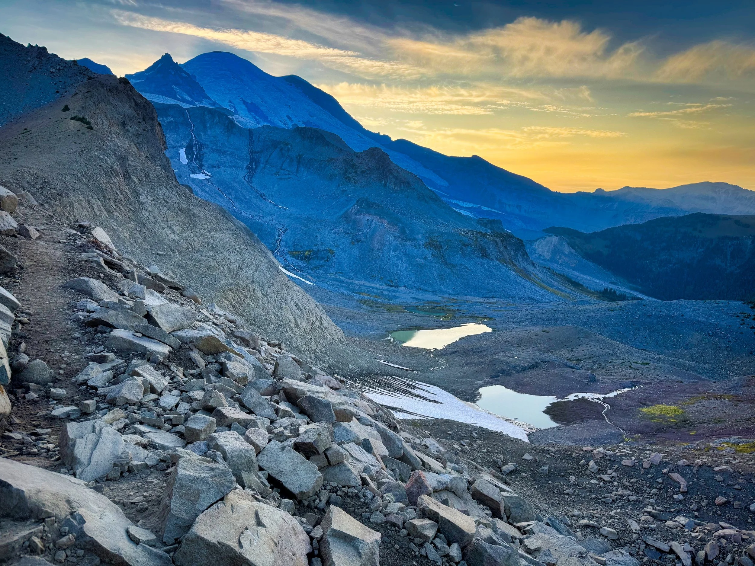
The "Eastern Loop Trail" is not an official description like the Northern Loop Trail, but I consider it a gem in it's own right and hikers should consider this trek for a number of reasons. Foremost is the ability to travel some of the most awesome alpine areas of the park (Indian Bar, Panhandle Gap and Summerland) and then experiencing classic Pacific Northwest old growth forest on excellent trail. In the case of the Eastside Trail, the slightly mild and undulating elevation provides relief from the elevation gains of the first part of the trip and finishes the loop in cool forest for hours of casual walking. I would recommend starting at the Cowlitz Divide trail head (2200') and proceeding to the junction with the Wonderland Trail (4800'/4.3 miles). This itinerary allows you to get the hard work of the loop done right away and hit the Gap later in the day when the snow is softer; however, nothing precludes one from going at a more casual pace and spending the night at Indian Bar (5000'/9 miles). The high point on this section is the appropriately named Point 5930. Depending on the time of year, the Cowlitz Divide is a spectacular place, especially after the snow melt and the plethora of flowers that line each mile. Bear, mountain chicken and elk abound in this area. Be aware that water is not to be found on the Cowlitz Divide so plan accordingly. Beyond what you will read there, this is a fantastic loop that will take you over some of the most dramatic parts of the Wonderland, namely the Cowlitz Divide, sporting some of the best vistas in the park, to Indian Bar, then over Panhandle Gap (6800’ • prime mountain goat viewing area) and Summerland to the Fryingpan Creek trailhead on the Sunrise Park road. You'll have to walk the road a short half mile to the Owyhigh Lakes trail head, where you'll ascend for the last time before dropping to the Eastside Trail and finish your hike amidst old growth splendor on gentle trail. It’s less than a mile on short connector trails to regain your vehicle. Possible camp spots follow. Click here to tour Olallie/Tamanos/Deer Creek. Click here for Indian Bar and Summerland.
Olallie Creek: just 3 miles into the hike, a good place if you got a late start and want to get going
Indian Bar: very popular and perhaps harder to get on a weekend, but that doesn't mean you shouldn't try.
Summerland: probably the most popular and sought after camp in the park due to its easy access from the road (4.3 miles) and fantastic scenery.
Tamanos Creek: this is a pleasant spot in the forest prior to the Owyhigh Lakes and assuredly easier to secure than Summerland
Deer Creek: easy access from Highway 123 but a pleasant spot nonetheless
I did this loop on July 9, 2013, over nighting at Tamanos Creek Camp. Feeling a little nostalgic, I used my Wonderland Trail update and photos/video taken on that trek, all captured on a GoPro Hero3. Recorded in 720P, run time 14:27.