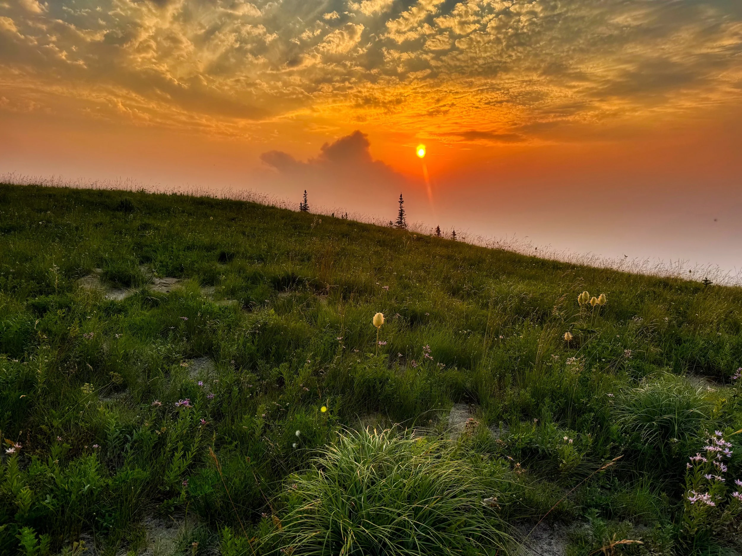
A smoky sunrise on the Cowlitz Divide, taken on day 2 of my Wonderland #40 first attempt
These files are completely unedited and are comprised of all shoulder mounted video I took on each excursion. If the viewer wants to take a deep dive into these forays, this is the place. Raw footage may contain profanity, therefore the occasional “mature” rating. Because of the length of these files, I encoded them in a minimal SD 640x480 format, so resolution is low. There are no annotations for time or position on the trail; again, totally unedited. The original 4K recordings are of course available in my edited versions. As an example, for Wonderland Trail #40 my edited version is 58 minutes, drawn from over 4 hours of video from different cameras. These videos are unlisted on Vimeo and are offered as a bonus for those viewers with the interest of seeing more detail. Good attention spans help. Hike #38 is added after #40 for those who want to see the CW version done in July. ADDITIONAL VIDEOS: Huckleberry/Grand Park Loop • Camp Muir • Klapatche Point to Golden Lakes (early season difficulties)
Wonderland Trail #40: These compilations are from all recorded shoulder mounted video for each of the 4 day transit, plus all the files from the aborted attempt on September 3-4.
Day 1-2 BAIL HIKE. With a 4 day permit in hand, I attempted #40 starting September 3rd. Day 1 was Longmire to Olallie Creek camp CCW (17.5 miles/4,700’ elevation). Day 2 was cut short when I was destroyed by heat and smoke and decided to exit the trail at White River (18 miles/5,000’ elevation). These two days do provide a good look at this eastern section of the hike since I was in daylight for both short days. Run time 49 minutes. This is the only place to view video from this hike.
WT #40 Day 1: CW, Longmire to Golden Lakes, September 10/2025 • STATS: 25 miles/8,300’ elevation. Run time: 56 minutes.
WT #40 Day 2: Golden Lakes to Mystic Camp, September 11/2025 • STATS: 25 miles/7,200’ elevation. Run time: 42 minutes. A short spin around the Mowich Lake campground, checking out the new bridge under construction, and a fine evening stroll over the Spray Park alternate route.
WT #40 Day 3: Mystic Camp to Nickel Creek, September 12/2025 • STATS: 31 miles/7,400’ elevation. This day takes us over Skyscraper Pass, past the Sunrise Camp, through White River campground and a late afternoon transit of Summerland and Ohanapecosh Park, ending with waning light before the descent to Indian Bar. Indian Bar and the transit over the Cowlitz Divide to Nickel Creek was during the night. Run time: 49 minutes.
WT #40 Day 4: Nickel Creek to Longmire, September 13/2025 • STATS: 14.5 miles/2,700’ elevation. This was a relaxed amble, with a relatively short day. I arrived at Longmire with plenty of time to shower in the van and have lunch with my daughter, who had met me on the trail; a complete surprise. Run time: 49 minutes.
Wonderland Trail Hike #38: CCW July 22-24 and August 13
WT #38 Day 1: Longmire to White River, July 22/2025 • STATS: 33 miles/8,800’ elevation. Profanity in this one when I was trying to film some hikers with their phone and realized I had screwed it up. Also, there is an extended period where the camera was running through Ohanapecosh Park, unbeknownst to me. I am talking to Mike, hiking behind him. Leaving it in, no editing! This makes it a long one, run time 1:25.
WT #38 Day 2: White River to Mowich Lake, July 23/2025 • STATS: 26 miles/8,200’ elevation. Alternate route over Spray Park. As I say in the video, by the time I was approaching Mowich Lake I was completely knackered. A tough day and a chilly night in my minimalist sleep system.
WT #38 Day 3: Mowich Lake to Longmire, July 24/2025 • STATS: 36 miles/6,200’ elevation. This was a tough one in that I developed blisters under callus on my right foot, which was very painful. I elected to exit the Wonderland trail proper at the intersection with the South Mowich River and proceeded via the South Mowich River Trail to the Round Pass Trail, then on the West Side Road to the main drag. This road walking saved my feet despite the long distance to get back to Longmire. Run time 31 minutes. I would come back a few weeks later to hike the missed portion from South Puyallup to Longmire.
Makeup day: August 13/2025. In order for WT #38 hike to be "legit" I decided to cover the trail section I had missed by using the West Side Road to save my feet. With healed feet and a different pair of trail runners, I biked from Longmire to the West Side Road, then hiked the road to Round Pass, then the Round Pass Trail to the South Puyallup River Trail, then back on the Wonderland. Despite this extra effort, the benefit was I could do this whole section in daylight, good for video. STATS: Bike 8 miles/800' elevation • Hike 19 miles/4,700' elevation. Run time 56 minutes.
Camp Muir: April 17, 2025 • STATS: 8 miles/4,900’ elevation. I elected not to do this as a ski. Consolidated enough on the climb to fare well with spiked trail runners, but later on the descent gross postholing had me wishing I had skied down. Gorgeous day, this unedited combo of shots will give you a sense of the continuous slog. Basically, the view changes little on the way up, but at least on the descent you can gaze on the Tatoosh range and spot Mt. Adams, St. Helens and even Hood in the distance. Not to be taken lightly, especially in iffy weather. Rated Mature due to one swear word. Run time 50 minutes, encoded in HD at 1280x720.
Klapatche Point to Golden Lakes: This is the hike portion of an overnight to Golden Lakes. On June 9th, I biked from Longmire to the West Side Road, then hiked from Klapatche Point via the North Puyallup trail to the Wonderland, then on to Golden Lakes. This is a classic look at early season difficulties on the trail when dealing with blowdowns and snow and the attendant navigation difficulties. STATS: 8 miles/2,100' elevation. Total stats for the trip: Bike Longmire to Klapatche Point: 37 miles/4,400' • Hike RT Klapatche Point to Golden Lakes: 16 miles/3,300' elevation. Run time 58 minutes. Encoded at 1280x720, no editing.