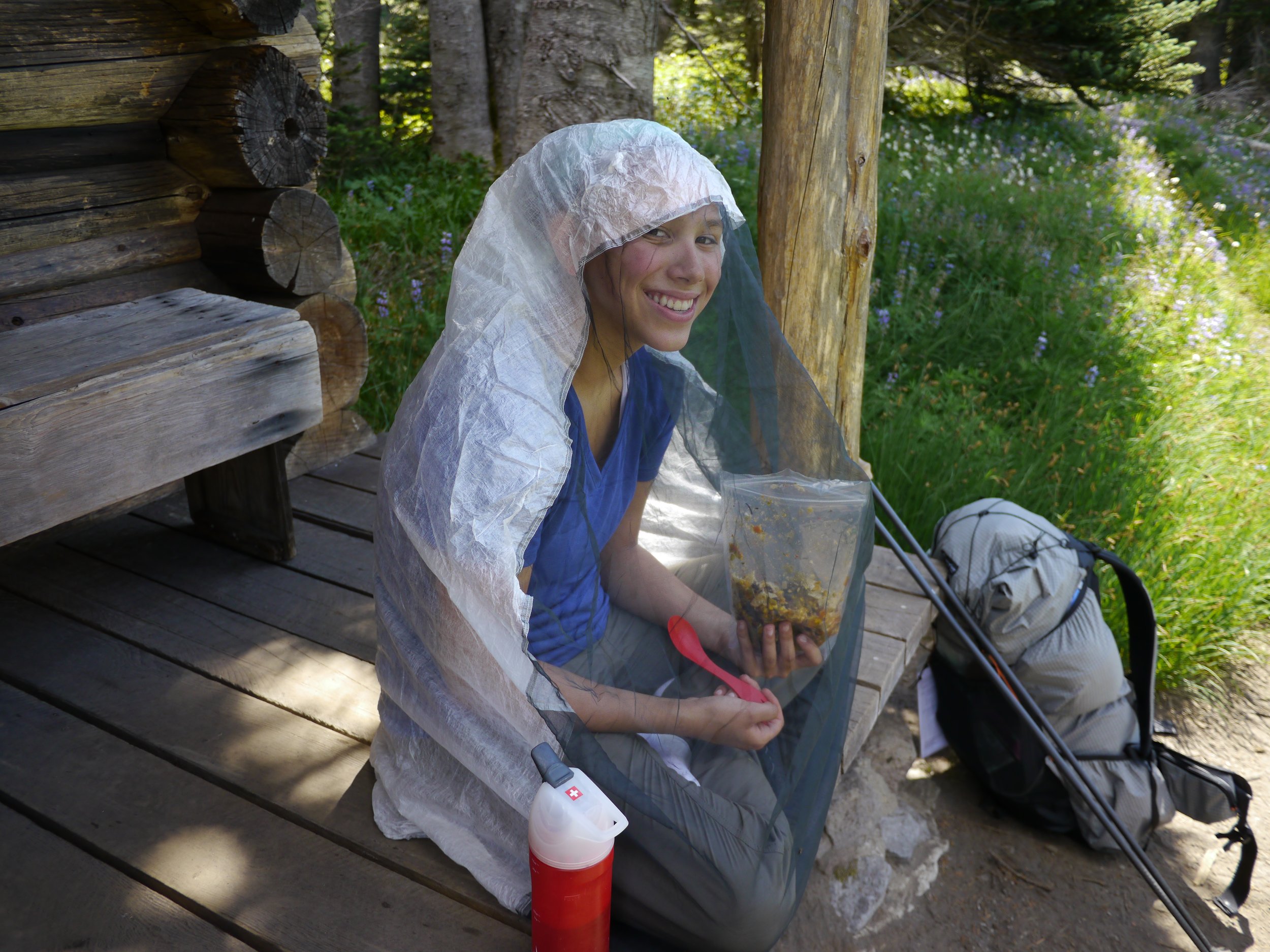
Willis Wall

CELEBRATE THE OUTDOORS

40 years outdoors experience, extensive info on Mt. Rainier’s Wonderland Trail, original music, equipment reviews, off trail videos, other peaks in Mt. Rainier NP

  • About
  • Wonderland Trail
    • Willis Wall's Views on the Wonderland Trail
    • Wonderland Trail: Complete Video Series
    • Wonderland Trail Backcountry Camps
    • Alternate Wonderland Trail Camps
    • The Northern Loop Trail
    • Wonderland in 13 Minutes CCW
    • Wonderland Enhancement Videos
    • Early Season Challenges
    • Wonderland Shorts
    • Hiking the Wonderland Trail (2006 DVD)
    • My Wonderland
    • Wonderland Trail Post 2006 flood (2007)
    • Pain and Suffering: Wonderland Trail in 3 Days
    • Wonderland Trail 2010: the "selfie" 3 day hike
    • Wonderland Trail Transits 32-37
    • Western Loop
    • Mowich Rivers 2023
    • Mowich Rivers 2012
    • Annual Compilations
    • Wonderland Trail Photo Gallery
    • Mt Rainier 7Up Hikes
    • Filming the Trail
    • Past Updates
  • Willis Wall Blogs
    • Willis Wall Blog
    • 60
    • Blog Posts Reference
    • 68/35
  • 35 Years in MRNP
    • 35 Years in MRNP
    • Mt. Rainier Hikes 2018
    • Mt. Rainier All Trails gallery
  • 360 Videos
    • 360 Videos
  • Grand Tour (MRNP)
    • Grand Tour (MRNP)
  • Travel
  • Off Trail
  • Video Guide
    • Complete Video Guide
    • Biking Mt. Rainier
    • Eliot Creek Crossing: Timberline Trail
    • Paradise to Camp Muir
    • Hurricane Ridge Road Bike
    • Mt. Baker Highway 542 bike
    • Washington Pass Bike (Cascades)
    • Mowich Lake Road
    • Films under construction
  • Shorts
    • On The Rocks
    • The Spit
    • Enchanted Valley Chalet Tour
    • Look Up!
    • Wonderland Short: Jaunt to Summerland
    • Wonderland Short: 2011
    • Wonderland Short: 2015
    • Wonderland Short: Emerald Ridge
    • Wonderland Short: Frozen
    • Wonderland Short: Stevens Canyon washout area
    • Mt. Rainier West Mini Loop
    • Longmire to Muir to West Side Road
    • The Hummock
    • Peakaboo
    • The Other Campground
    • West Side Road
    • Carbon Glacier
    • The Seattle Viaduct (SR99)
    • Off Trail
    • Lane Peak Gully
    • Sunshine Point
    • Chasing Turbo
    • Mt Kilimanjaro
    • Rainier in Fall
    • Skyline Trail Improvements
    • Old Black Diamond
    • Left of Spring
  • Music
    • Music
    • Audio Samples
    • Anthology
  • Search
  • Contact
    • Contact Willis Wall

Morning alpenglow from the meadows below the Burroughs Mountains

Northern Loop Trail

August 07, 2023 by Willis Wall

A busy July precluded any hiking that month, so I hit the Northern Loop Trail (Mt. Rainier National Park) on August 3rd in preparation of hiking the full Wonderland shortly thereafter. The Northern Loop Trail (NLT) approximates the toughest day I may see on a 3 day Wonderland, coming in at 38 miles with 9,800’ of elevation gain. Over 20 years ago I would do this trail in under 12 hours as training for ultras. This iteration took considerably longer; 18 hours total. Generally speaking, the hike went well with the last 10 miles offering a test of legs and mettle. There is a video chronicle at the end of this post.

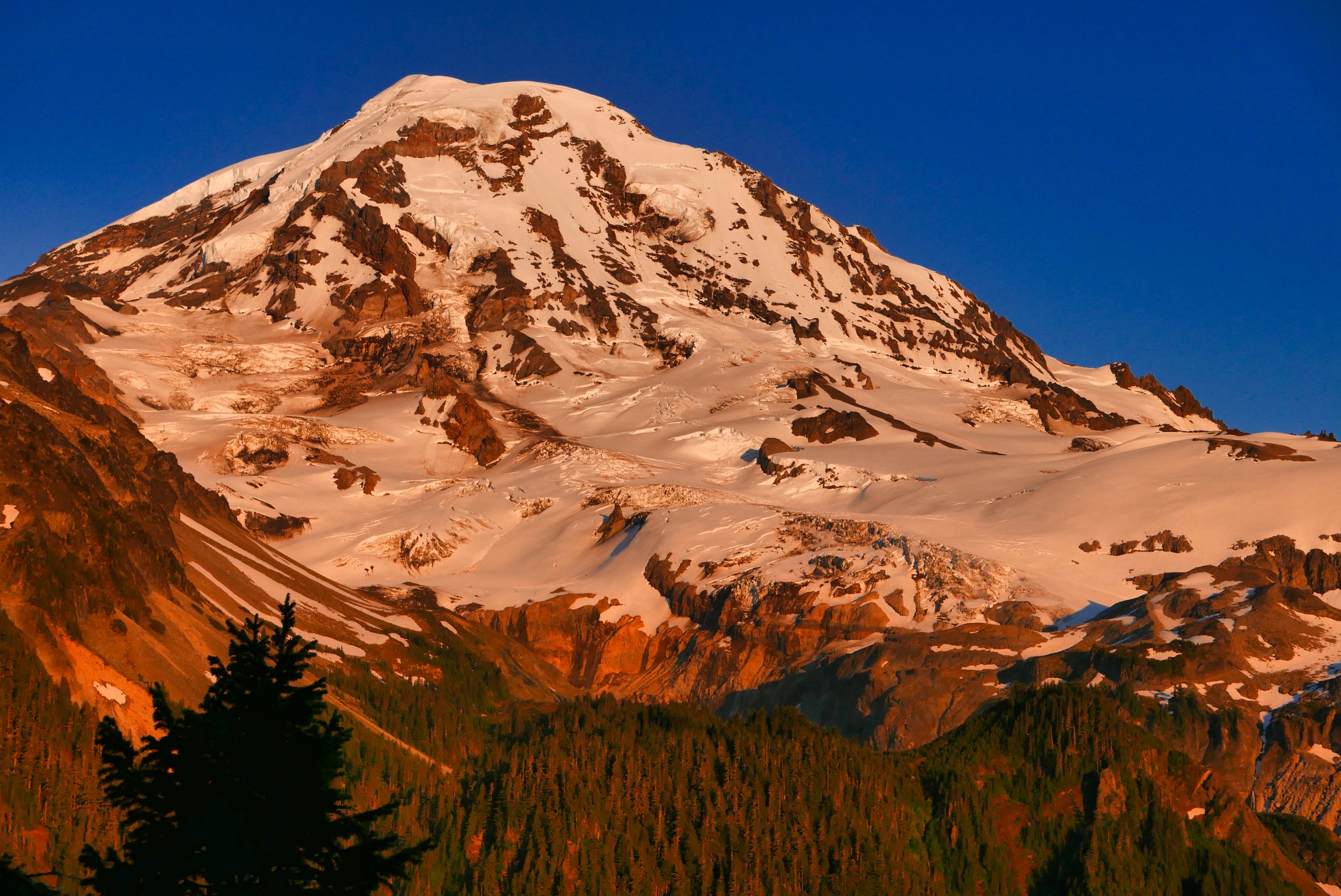
Mt. Fremont from Grand Park

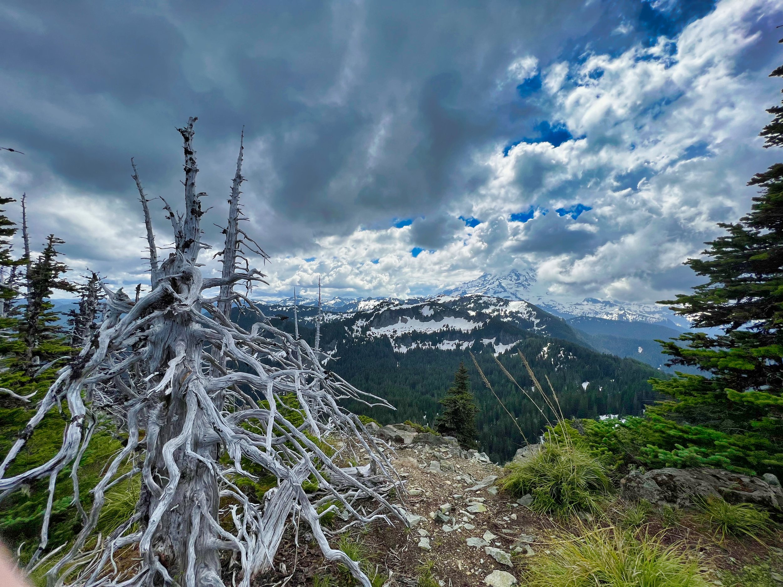
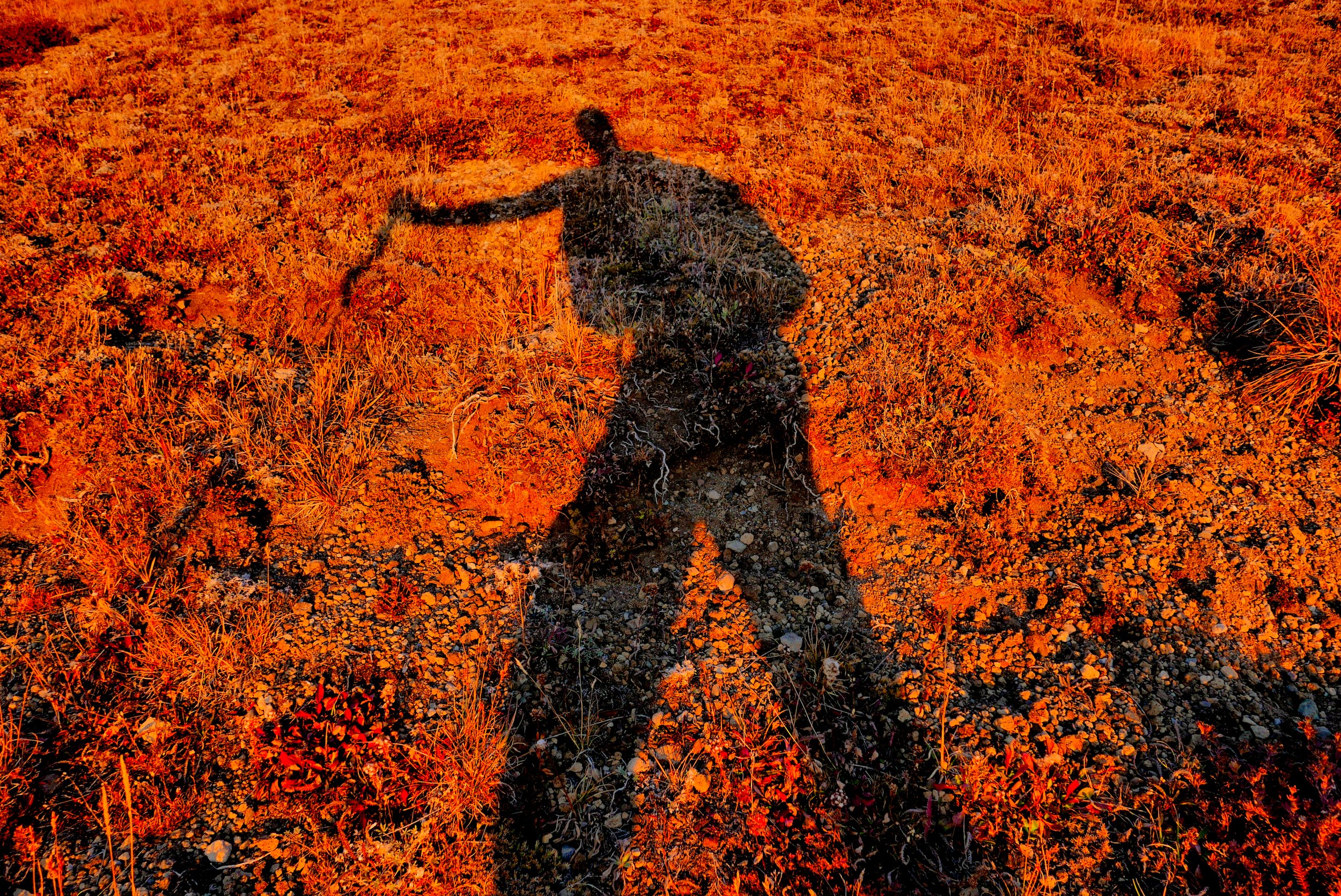
I got an early start at 5:30 AM at Sunrise, enjoying spreading alpenglow from the meadows beneath the Burroughs Mountains. A highlight of the trip is the jaunt through Berkeley Park, with the fairy tale like Lodi Creek bubbling along the way, feeding flowers late into the season. A relatively short wooded section deposits the hiker on the far end of Grand Park, the unique anomalous flat mesa. As I stepped along the trail in bright morning sunshine, thousands of tiny grasshoppers took to short flights to avoid my feet, parting the way like a bow wave. The snapping sounds they made as they hopped away reminded me of popcorn. This experience is just one of the surprising delights that happen on the trail, being in the right place at the right time by happenstance. As a parting shot the mountain offers up a grand view before dropping over 2,000’ to the West Fork of the White River.

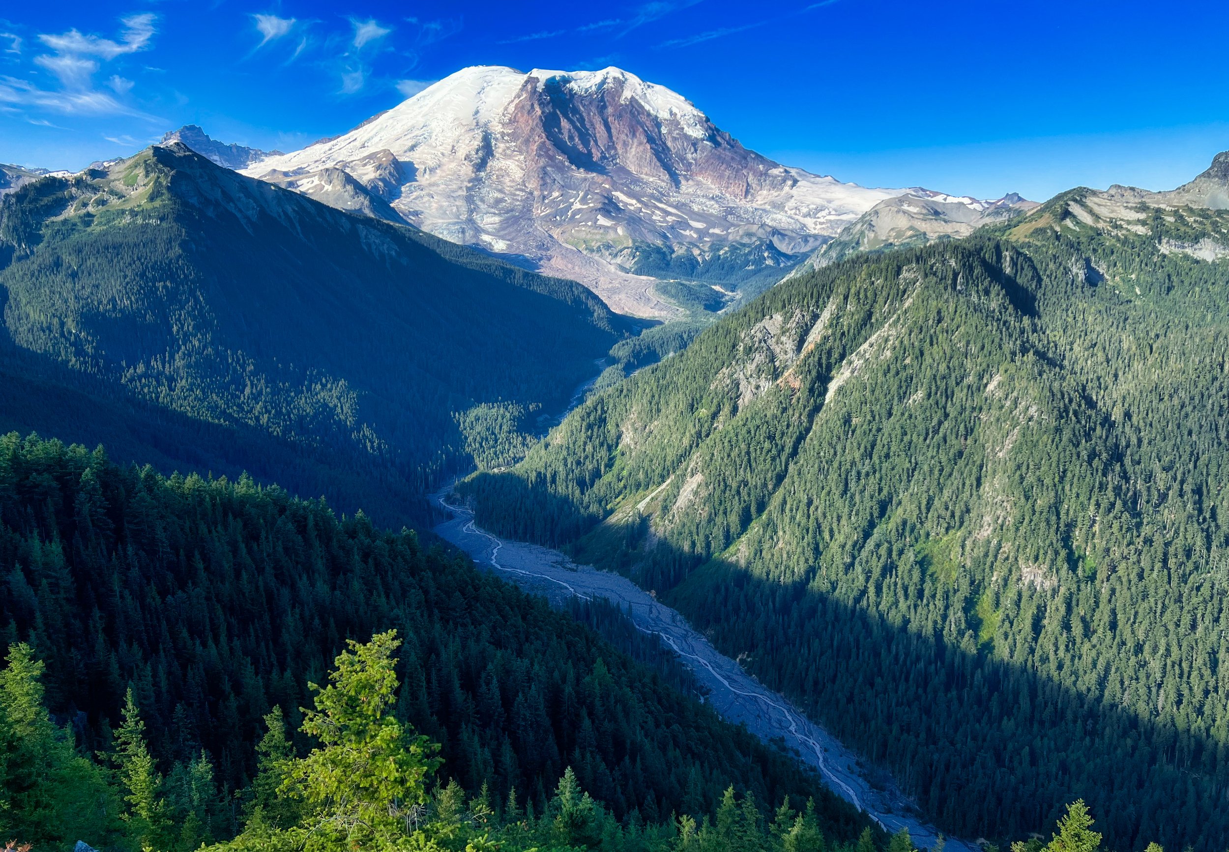
A grand view leaving Grand Park, Mt. Rainier National Park

The crossing of the West Fork is a bit convoluted, and I actually lost the trail by following an older version for a bit before realizing my mistake and backtracking. No further navigation problems were encountered after this brief distraction and I enjoyed the climb to Windy Gap, legs and motor still cooperating as I approached the half way point mileage-wise. This second drop from nearly 6,000’ to 2900’ taxed the downhill legs, always the weak area without a good amount of prior trail miles under my belt. I was glad to start climbing again and intersect the Wonderland, which comprises the rest of this loop. Glorious conditions, changing views and cool breezes helped mitigate the growing fatigue creeping up on my untrained old bod.

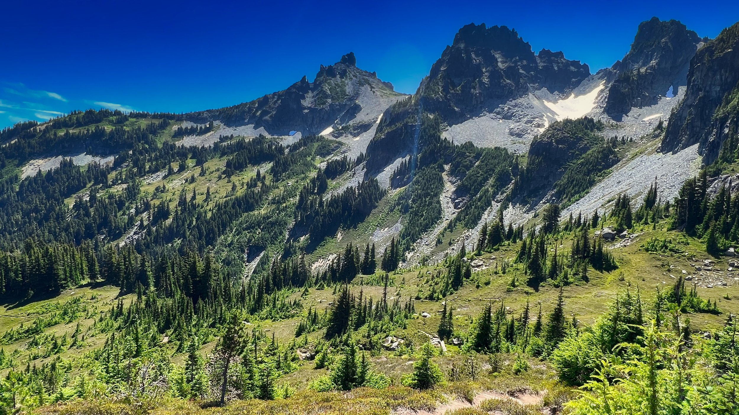
Sluiskin Mountains approaching Windy Gap

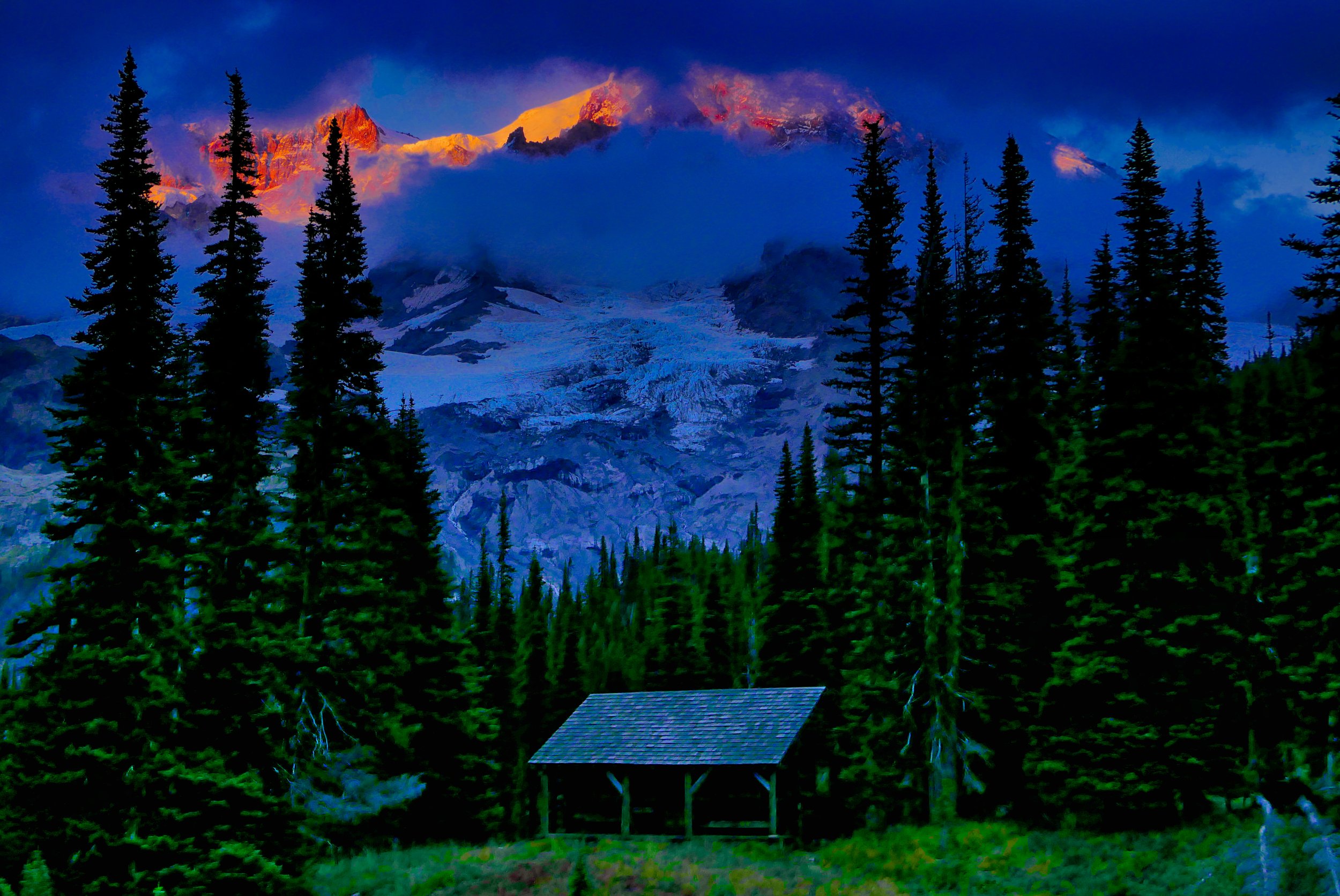
As I crested Mystic Pass (6,000’) and descended to Mystic Lake, I knew the last 10 miles were gonna be a challenge. I waded in the cool waters of Mystic Lake, enjoying some snacks while basking in the warm sun, delaying my departure knowing what was ahead; hours of degrading legs, sputtering motor and mental challenge, conditions I am so accustomed to I almost welcome this suffering as an old friend. By this stage in life I can still enjoy my surroundings despite the toil, and I appreciated a rising moon and passing fox as I shuffled toward Sunrise. Doing hard stuff accentuates the good stuff, my ineloquent quote for the day.

Mystic Lake

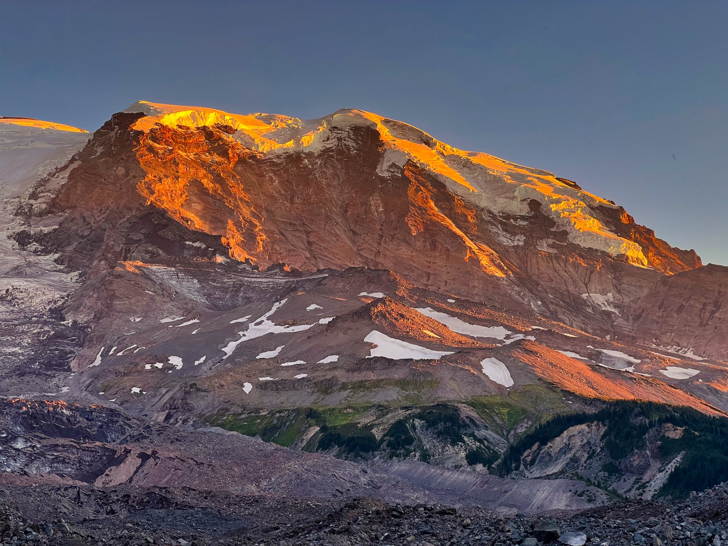
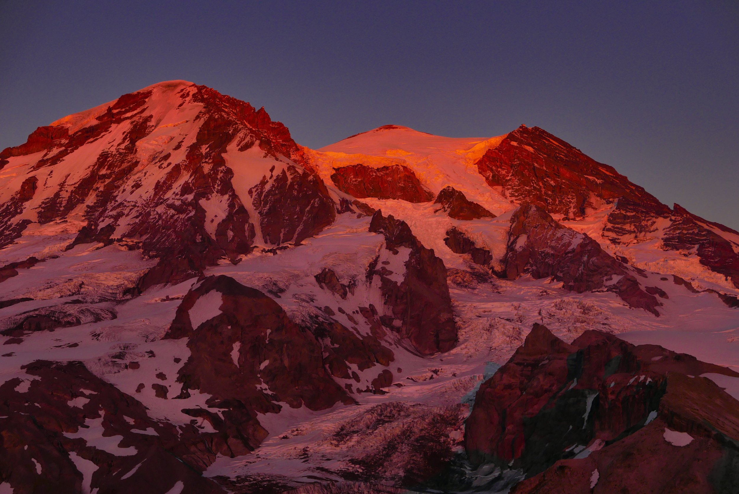
Evening alpenglow from the Northern Loop Trail (Winthrop Glacier)

August 07, 2023 /Willis Wall
mt rainier northern loop trail

Mt. Rainier from the summit of Mt. Wow (6040’)

Mt. Wow (6040')

June 09, 2023 by Willis Wall

Finally...this was a tough one for me. In 2019 I attempted it early November from the West Side Road, lost my Whippet in some dense brush schwacking to reach the upper meadows, and found fresh snow on the steep meadows. I turned back there as the days were short and finding that Lake Allen "trail" in the dark was not appealing. I made another half hearted attempt with a buddy the next year but he had concerns so we turned back. And a few weeks ago I scouted the route from the Boundary Trail (Nisqually entrance) and turned around below the ridge because of snow. I opted for the WSR/Lake Allen approach again as I was at least familiar with the difficulties involved.

The upper meadows below the Mt. Wow ridge

This is an unrelenting climb...6.7 miles RT with 5000' of elevation gain/loss, at least according to my track on Strava. This time I was able to proceed up the upper meadows (mtn goat sighting) and easily gain the ridge to Wow. As I crested and Rainier came into view, the words that escaped my mouth were "Holy Crap!" The mountain is massive from this vantage point and you can gaze down on the course of Tahoma Creek from its origins. After a break on the summit (6040') I reluctantly left this glorious perch and steeled myself for the descent. The Lake Allen trail is in poor shape and is easily lost/reacquired in the descent. I found myself on my backside a few times sliding down the hill and I won't repeat the epithets that spewed forth from my pie hole. When I finally regained my van on the road I felt completely worked, but very glad not to have to go up there again. This was #67 on my Rainier 100 list. The next day I recovered by biking the West Side Road and Paradise from Cougar Rock, a delightful and zen like day for 60 miles and 6600' of no sidehilling on my MTB pedals.

Mt. Adams to the south

Mt. Wow ridge

June 09, 2023 /Willis Wall
mt wow, mt wow mt rainier national park, peak bagging mt rainier

Mt. Rainier from the summit of Florence Peak (5508’)

Florence Peak (5508')

May 27, 2023 by Willis Wall

Well worn path at the beginning of the hike on the Rainforest Loop

The shorter drive to the Carbon River entrance at Mt. Rainier National Park enticed me to tag Florence Peak (5501’) as it is one of the easier peaks to access and has a way trail all the way along Alki Crest, making travel pleasant. The Boundary Trail starts right at the Carbon River entrance, and the park is maintaining at least the first section to the creek crossing and falls. Irish Creek was running fast and I dropped a bit below to cross, but it was still a bit dicey on the slippery scale. On the way up the trail I saw a well used log that would be a much better alternative on the way back.

The great thing about Florence is that the Boundary Trail takes you right to the saddle, and a social trail continues up Alki Crest right to the false summit of Florence; no ‘schwacking at all beyond stepping around or over a fallen tree. An easy scramble to the summit bloc proper allows 360 degree views. Although somewhat cloudy, the main mass of Rainier was visible as one peered at it across the ridge housing Tolmie Peak fire lookout and, beyond that, Observation and Echo Rocks. A big plus was that it was still early enough in the season (May 26) that there were no bugs to deal with. I lingered for a while, got my drink and snack on, took some pics and 360 video, then retraced the path. There was an aborted attempt to access Sweet Peak but I found myself in gawdawful slide alder and devils club, sometimes over blowdown, snow and mossy rocks. I figured I had made some poor navigation decisions and determined that best course of action was to make my way back to the trail and leave Sweet Peak for another day.

Irish Creek waterfall on the Carbon River Boundary Trail

Florence was my first peak of 2023 and is number 66 on my 100 list. With luck, I may be able to top out on 10 more peaks this season amidst a very busy summer and fall. Happy Hiking and be safe out there!

Florence Peak summit area, Mt. Rainier National Park

May 27, 2023 /Willis Wall
florence peak mt rainier, peak bagging mt rainier

Borah Gear custom Cuben WPB bivy with NeoAir XLite inside, 30 degree quilt

Throw Down Sleep Systems

May 23, 2023 by Willis Wall

Oh, if only it were simple. But no, there are many options for a throw down sleep system, each having its own up and downside. Let’s explore what I have available in my gear closet. Some iteration and combination of these items will make it into my pack for my 35th Wonderland Trail fastpack. NOTE: many of these items are No Longer Available for order or new purchase, annotated “NLA”

THE EASIEST: In 1999 I did a 36 hour transit of the Wonderland Trail. All I had was a hydration pack, some food and Montbell rain top and bottoms. At some point after going 24 hours I decided to get some sleep at Ipsut Creek Campground (when it was still a drive in) somewhere around midnight. I had started at Longmire and proceeded CCW, through Sunrise, past Mowich Lake and then Ipsut. I found an empty spot and laid down on a picnic table with all my clothes and rain gear on. This was not comfortable or warm, to say the least. Finally, around 4 AM, the cold was making me shiver so I got back to ambulation and finished the hike, stumbling into Longmire in a stupor. So the simplest method is just to lay down somewhere with your clothes on, but probably the most miserable.

Most of my transits of the Wonderland have been 3 day affairs, so seldom have I toted a tent. Bivies are my go to method and I’ve used various systems throughout the years.

The zpacks 3 oz pocket tarp, custom Arc Slim pack, and Poncho/Groundsheet on a Glacier Peak circumnavigation

THE ZEE: About 10 years ago I used a custom breathable Cuben half bag made by ZPacks (about 6 ozs) and an Xtra Large long breathable Cuben jacket (5.7 ozs), also made by ZPacks. For a pad I used a ZRest, cut in half, and put my pack under my feet/legs. The jacket was roomy enough to put my arms inside and I was toasty enough, wearing a down jacket (5 ozs). But crawling into this setup was laborious, and getting up to pee was a pain.

Custom made ZPacks WPB Cuben half bag on NeoAir XLite on ZPacks poncho/groundsheet: 2013

THE LIGHT: Many times I’ve used my ZPacks poncho/groundsheet as a groundsheet (5.7 ozs), a Borah Gear Cuben bivy (4.7 ozs) and an EE 50 degree quilt (9 ozs). I also carried the first iteration of the ZPacks Pocket Tarp, which was made of the whisper thin Cuben (yeah, I know its now Dyneema Composite Fabrics, but back then it was Cuben) coming in at 3 ozs, plus another ounce for stakes. This was merely in case of unexpected weather. I can use whatever pad I need in this configuration

THE LIGHTEST: A pad (various, but probably the Gossamer Gear 4 oz tri fold foam/NLA), the Mountain Laurel Designs bag liner as a bivy (3 ozs), and clothing (various).

OR Wilderness Cover with Nunatak Akula Half Bag and Skaha Apex Pullover

THE OR: It’s on the heavier side (24 ozs/NLA-does not show up on the OR site), but the OR Wilderness Cover is heavy duty enough to throw on the ground with no worries of a ground sheet (assuming relatively dry ground), and doubles as rain gear. It’s also roomy enough to put any of my pads inside along with a quilt or bag. This would pair well with my Feathered Friends 35 degree Rock Wren (about 1.5 pounds/NLA), which can be used standing as the bottom opens and has arm holes with zippers and a hood. Despite the weight, this combo has advantages…I put on the Rock Wren, I throw down whatever pad on the opened Wilderness Cover, lie down and zip up. Pretty convenient.

Nunatak Nova bivy (right) with nested Nano 40 degree quilt

THE NUNATAK: This may be the easiest one and ranks high for this year’s Wonderland. I throw down a ZRest, either the full length (bulky) or the half length, then crawl into my Nunatak Nova 50 degree bivy/(NLA). I’ve tried this with an XLite pad but the slippery factor is high, I’d be falling off that pad all night. Plus the Nova is not roomy enough for a blow up pad inside, and the material requires some kind of ground protection…7D Robic weather resistant fabric, so needs some TLC but sheds light mist and moisture. However, this is not appropriate for outright rain. PART II: I also have the option of the Nunatak Skaha Apex Pullover (12ozs/NLA) with Nunatak Akula half bag (12 ozs/NLA) on top of the ZRest, perhaps utilizing my B4 bag for bug and upper body protection (2 ozs). However, the half bag does have a Robic material hood so only my face would be exposed while prone.

Feathered Friends Rock Wren in an open bivy, Mt. Rainier’s Wonderland Trail

THE TIMMER: Another contender for ease of use…I can roll the entire system up for immediate employment (see last photo) and just crawl in (after blowing up the NeoAir XLite NXT Short/11.5 ozs). Plus, it’s an all weather shelter. Bivy: custom Borah Gear eVent Cuben bivy (9 ozs; fully waterproof)/Timmermade custom Alpha Direct Overbag (8 ozs). I would supplement this with the Timmermade Alpha Direct 4004 hooded sweater (7 ozs).

My homemade B4 bag for bug protection

Timmermade Alpha Direct Overbag

OTHER CONSIDERATIONS: I’m willing to sacrifice some weight for ease of use and less fiddling. On full bore outings like a 3 day WT, I’m on my feet for upwards of 17 hours per day. When I’m ready to crash I don’t want to spend precious minutes setting up; even blowing up a pad is a pain. Another big factor is weather; the advantage of fastpacking the WT in 3 days or less is the luxury of going when the weather forecast is good. This year, if my training continues as planned, I may be able to pull off a 48 hour trip. In that case I’ll be packing as little as possible and looking to rest for probably 4-7 hours one time.

I’m not thinking of trying another trip like in 1999, that was too much suffering. But for just a little more weight, I can take along a throw down rest system that will keep me comfortable and warm enough to get some precious sleep.

LIST OF MY POSSIBLE COMPONENTS: (NLA=No Longer Available)

BIVIES/SHELTER: ZPacks WPB half bag (6 ozs/NLA) /// Borah Gear Cuben bivy (4.5 ozs with side zip) /// Borah Gear custom eVent Bivy w/Cuben bottom (9 ozs/NLA) /// Nunatak Nova 50 degree insulated bivy (15 ozs/NLA) /// OR Wilderness Cover (24 ozs/NLA) /// Mountain Laurel Designs bag liner (I have used this once as a bivy - 3 ozs) /// Nunatak Akula half bag (12 ozs/NLA) /// My B4 bag (2 ozs)

PADS: no pad, just duff (yes, I have done this - 0 ozs) MLD 1/8 inch foam (6 ozs) /// ZRest half pad (7 ozs) /// ZRest full pad (15 ozs) /// NeoAir XLite (15 ozs) /// NeoAir XLite NXT Short (11.5 ozs) /// Gossamer Gear tri-fold foam pad (4 ozs/NLA))

SLEEP CLOTHING SUPPLEMENT: Timmermade Alpha Direct 4004 hooded sweater (7 ozs) /// Borah Gear down sweater (5 ozs/NLA) /// Nunatak Skaha Apex Pullover (12 ozs/NLA) /// Nunatak JMT Hooded Jacket (7.8 ozs/NLA)

Complete rest system/full protection: custom Borah Gear Cuben/eVent bivy (9 ozs)/NeoAir XLite NXT short (66” - 11.5 ozs/Timmermade Alpha Direct 4004 Overbag (8 ozs) = 28.5 ozs total throwdown weight

So much depends on my overall health, conditioning and weather. If the forecast is warm, I can skip a bag and just use the MLD bag liner over clothing. Transits later in the season would require warmer and more robust shelter/sleep to be prudent. If I’m in top form, I can get away with much less if I’m only going to rest once, spending the majority of my time on my feet…sorta like an ultra, but slower (my last ultra was Western States in 2001). Final decisions will be made when the stars align for timing and the state of my overall conditioning, which is progressing well. Note: this year’s progression and thoughts are specifically on my 68/35 blog.

May 23, 2023 /Willis Wall
bivy bags, throw down sleep systems, nunatak nova bivy, borah gear cuben bivy

A steep part of the ridge, accessed from the Boundary Trail, Mt. Rainier.

Oh, those downhill legs!

May 20, 2023 by Willis Wall

One of the hardest parts of training for hiking or trail running is the downhill legs, the front part of your quads that provide the braking action. I usually hit a few trails in the spring and run downhill, trashing that particular part of the quads to get that first round of pain out of the way. After that initial shock, they recover well and it’s off to the races.

This year I’ve spent a lot of time on the bike trainer, and my aerobics and general leg strength are in top form, at least for a 68 year old. I considered that Phase I, which culminated in participating in an 8 person team for the Great American Ride (virtual ride across America, over 3700 miles). Over 17 days, I logged 959 miles with one day off and one day for skiing (our team finished 4th overall, and 2nd for 8 person teams). I felt as fit as I’ve been in years because of the consistency of targeted training.

Snow at 4900’ below Mt. Wow, Mt. Rainier

Phase II began after a two week vacation, providing good rest for the bod and a break from training. This of course gets me back on the trails and getting in elevation gain and loss for those particular muscles other than biking. I managed a slow trot on my first outing with not much elevation for a 9 miler…so far so good.

And then I wanted to hit Rainier and try the Boundary Trail at the Nisqually entrance, checking out this longer route to Mt. Wow, which I failed to summit in 2019. Parking a short distance up the road after entering the park, I walked to the Boundary Trail, located right at the entrance. The weather was fine, even on the warm side on this mid May Wednesday, and the Boundary Trail (BT) is on the steep side. It ends at a saddle and from there I proceeded up a ridge toward Mt. Wow, dropping into a bowl and proceeding a short ways before turning around on snow covered slopes at 1 PM. This was more of a scouting trip than a serious attempt.

Rocky outcropping on the ridge leading to Mt. Wow, Mt. Rainier

The ridge has some particularly steep sections and some maneuvering around rocky outcroppings, kind of a full body workout. Once I regained the saddle I started trotting down the BT but couldn’t go too fast because of the grade. On it went, with hopping and scooting over fallen logs with the legs starting to get a little quivery. “Oh” I thought, “I’m really trashing those downhill quads, this will be a great session.” I realized I was in for some recovery pain when I leaped off a log rather than step over it; my legs collapsed when I landed, the braking muscles giving up the ghost with no juice left in them, leaving me squished like an accordion on my butt. I chuckled at this, and decided not to leap off any more logs and try to save my legs as much as I could for the remaining distance.

The aftermath was one of the most painful recoveries I’ve had in years. The day after I was walking like an old man, and the second day I was limping around and wondering how I was going to negotiate the two steps into the house. The quads were painful to the touch. So here it is, 4 days later, and I’m finally ready to hop on the bike and try to work some of the kinks out. BTW, the elevation gain/loss was 4,000’ over 11 miles total, nothing to brag about. But that was such a good workout I’m thinking of returning this coming week and doing it again, this time with the thought of summiting Wow. Hopefully this trashing will not be repeated.

A painful but glorious day on Mt. Rainier’s Boundary Trail (Nisqually entrance)

May 20, 2023 /Willis Wall

A circumnavigation of Mt. Rainier with deviations from the traditional Wonderland Trail route

Mt. Rainier Circumnavigation CCW (with deviations)

April 08, 2023 by Willis Wall

This is a repeat post from my 68/35 blog which I deem relevant to this overall blog

Yes, the Wonderland Trail encircles Mt. Rainier. This proposed circumnavigation route borrows elements from my Grand Tour and utilizes the Wonderland during this circumnavigation, but incorporates deviations/off trail segments that will depart the Wonderland and venture into areas not seen by a traditional Wonderland circuit. Starting from Longmire, Deviation 1 (D1) will proceed up the Eagle Peak trail and transit the Tatoosh range to exit at the Snow Lake trail. D2 is a possible deviation that would depart the Wonderland on the Cowlitz Divide and skirt the Wilson and Ohanapecosh Glaciers above Ohanapecosh Park to rejoin the Wonderland at Panhandle Gap. I have not explored this route yet. After departing Summerland, the route proceeds over Goat Island Mountain to White River, then departs the Emmons Moraine Trail to proceed cross country on the left side of the White River to descend to Glacier Basin. There is a cross country route from the area of Second Burroughs to arrive at Skyscraper Pass, then to Berkeley Park and the Northern Loop Trail to Windy Gap (if not climbing Sluiskin Mountain). From Windy Gap the route ascends over Crescent Gap, through the Elysian Fields and exiting in Moraine Park. An alternate plan is to break off before Windy Gap to climb Sluiskin Mtn Squaw, then drop into Vernal Park and over Old Desolate, avoiding the Elysian Fields altogether. Another unexplored option is crossing the Carbon Glacier and climbing to Seattle Park (D6), a route that was used for almost 20 years in the earliest iterations of the Wonderland Trail. Rejoining the trail in Spray Park, I would then proceed over Knapsack Pass for a short distance before climbing to the ridge (right) above Mowich Lake (towards Castle Peak), then back on the Wonderland all the way to the North Puyallup Camp.

An earlier trip climbing out of the Elysian fields towards Old Desolate (D5 alt)

Bypassing the climb to Klapatche Park, I will proceed via the North Puyallup Trail to Klapatche Point on the West Side Road, run the road until hopping on the St. Andrews Creek Trail, climb out of Klapatche Park to St. Andrews Lake and exit the Wonderland to circle around Andrew Benchmark to rejoin the trail. With just a few deviations to go, I’ll take the Mirror Lakes Trail to Pyramid Park, transit the park and exit back to the Wonderland via the Fishers Hornpipe drainage. The last deviation (D10) will see me descending to Longmire via the Rampart Ridge Trail to complete the circumnavigation.

Ridge above Mowich Lake, looking towards Castle Peak (D7)

Pyramid Park (D9)

I don’t know how much extra mileage and elevation this route will entail; I estimate maybe 120 miles+ and an additional 5-10,000’ in elevation. The packing for this trip will be significantly different from a traditional Wonderland fastpack, as I’ll be staying in cross country zones and will be carrying significantly more food and equipment. I’ll figure it out though and look forward to this challenge. What shall I call it though?

Cross country terrain between Wahpenayo and Lane peaks (Tatoosh traverse)

April 08, 2023 /Willis Wall

Happy Holidays from willis wall!

A Holiday Music Collection

December 23, 2022 by Willis Wall

I’ve been accused of writing off kilter music, but when it comes to holiday arrangements I’ve kept things pretty “normal.” There’s snow outside my window so I assembled some of these arrangements for aural entertainment. I’ll start with showcasing the vocal talents of Darrell Dodge, who did a bang up job on this arrangement of “Have Yourself a Merry Little Christmas.”

With the exception of practicing over 6 months for a college Incubus band reunion (plus big band ensemble) many moons ago, I really haven’t touched my horn since 1978. However, I did pull out the flugelhorn in 2013 and managed (after many takes) to do this short arrangement of “Let it Snow.”

Here’s a trio arrangement of “Blue Christmas” from 2016.

I got my big band on for this instrumental arrangement of “White Christmas.”

And finally, for those who are thinking I’m pretty “normal”, there’s this piano interpretation of “We Wish You a Merry Christmas.”

December 23, 2022 /Willis Wall

Willis Wall 2022 Holiday Video

December 13, 2022 by Willis Wall

Another year of good fortune, good friends and good health is coming to an end. It’s hard to cram epic spring skiing, peak bagging, hiking, Kilimanjaro and cycling into 3 minutes, but I did. I hope the coming year sees good health to readers…Happy Holidays!

December 13, 2022 /Willis Wall

Sunrise alpenglow on Mt. Rainier (direct light)

Alpenglow

December 12, 2022 by Willis Wall

noun ‘al˙ pen˙ glow: a reddish glow seen near sunset or sunrise on the summits of mountains (Merriam-Webster dictionary)

(The following is from https://www.phenomena.org/atmospheric/alpenglow/) It is important to note that there are some discrepancies in books and internet sources on how alpenglow occurs and what it is. Some sources state that it is a result of direct light from the sun that is hidden behind the horizon. Other sources [state] that it is caused by indirect light that has been reflected off of atmosphere and other particles.

Mt. Rainier alpenglow from Eagle’s Roost

Direct Light: When alpenglow is caused by direct light, the sun has set behind the horizon from an observer’s point of view who is standing on the ground, far below the mountain tops. In this case, direct sunlight is still reaching the mountain tops, and if the observer were standing at the top of the mountains, they would see that the sun was still above the horizon.

Glacier Peak alpenglow from the PCT

The direct sunlight that is reaching the mountains has traveled through significant amounts of atmosphere, due to the sun’s position low on the horizon and the curvature of the Earth. When sunlight travels through more atmosphere, the small blue light waves in the sunlight get scattered, and only the longer red light waves get through.

peek-a-boo slice of alpenglow from Indian Henry’s (Mt. Rainier)

When these red light waves reflect off the mountains, it gives them a bright pink glow. If an instance of alpenglow is caused by direct light, shadows will be present and well defined.

Alpenglow on Ptarmigan Ridge (Mt. Rainier)

Indirect Light: When alpenglow is caused by indirect light, much of the mechanics are similar to when it is caused by direct light. The sun has similarly set behind the horizon for the observer on the ground, but it has also set for the observer on the mountain top.

Alpenglow caused by indirect light (from The Colonnade, Mt. Rainier National Park)

Sunlight from the sun still has to travel through significant amounts of atmosphere, due to the sun’s position near the horizon and the curvature of the Earth. Therefore, the light waves reaching the mountains are still red. But light from the sun is no longer directly hitting the mountains. The only red light waves that are hitting the mountains have been reflected off of elements in the atmosphere.

Morning alpenglow Mt. St. Helens

If alpenglow is being caused by indirect light, its effect is much less pronounced than when it is caused by direct light. The hue of the mountains are a dull pink to almost purple. There are also few if any shadows. According to Wikipedia, this is the only true alpenglow, but that is very much open for interpretation. (end reference)

Mt. Rainier alpenglow from White River

For the most part, I don’t position myself purposefully to capture alpenglow. Most of the time it is a happy confluence of being in the right place for viewing and the right time of day, with the right weather conditions. And, it’s not always the distant lofty mountain views that stun me; sometimes it’s right under my feet.

Skyscraper Pass, Mt. Rainier

Surrounded by the glow

December 12, 2022 /Willis Wall

AFRICA

November 27, 2022 by Willis Wall

The place, the animals, the song…arranged by willis wall, performed by old friends.

November 27, 2022 /Willis Wall
africa the song, tanzania, african safari, kilimanjaro
  • Newer
  • Older

© 2025 Willis Wall Multimedia

all rights reserved